 |
Dedication: Saint Mary the Virgin Location: Mary Well Street Coordinates: 50.80796N, -2.73972W* Grid reference: ST479011* Status: covered? |
A church is believed to have existed at Beaminster since the time of the Anglo-Saxons, although it may well have possessed a different location to that of the current building, parts of which are Norman. Of course, it is impossible to say whether the church, prior to the Norman Conquest, would have been under the same patronage as it is today: whilst St Mary has always been a popular figure, the Normans did re-dedicate a large number of Anglo-Saxon churches to her after their arrival. If the church was originally dedicated to a different patron, then it is possible that the holy well was too, as the well's proximity to the present site of the church suggests that the two were, at least during the late medieval period, closely linked.
Indeed, St Mary's Well was undoubtedly in existence by the late medieval period, although I have been unable to find any references to it that pre-date the 17th century. In fact, the earliest mention that I have found to the site dates from 1692, when, according to Richard Hine's History of Beaminster (1914), the following text was entered into "a parish book":
|
The Charge of the Stone Bridge that was new built in Mary Well street comes to £1 : 18 : 7. |
Hine writes that, at the time, "Mary Well street" was "an open river", with nothing but "a cobbled pathway in front of the houses" on either side of the water, although it had been completely covered over by 1832. Presumably, until this time, St Mary's Well would have been situated somewhere on the banks of this river, almost certainly accessed by one of the "cobbled pathways". By Hine's time, however, he claimed that the spring was "almost forgotten", and was allowed to "trickle unheeded into the river beneath the roadway", despite the fact that it had once been "supposed to possess great healing properties".
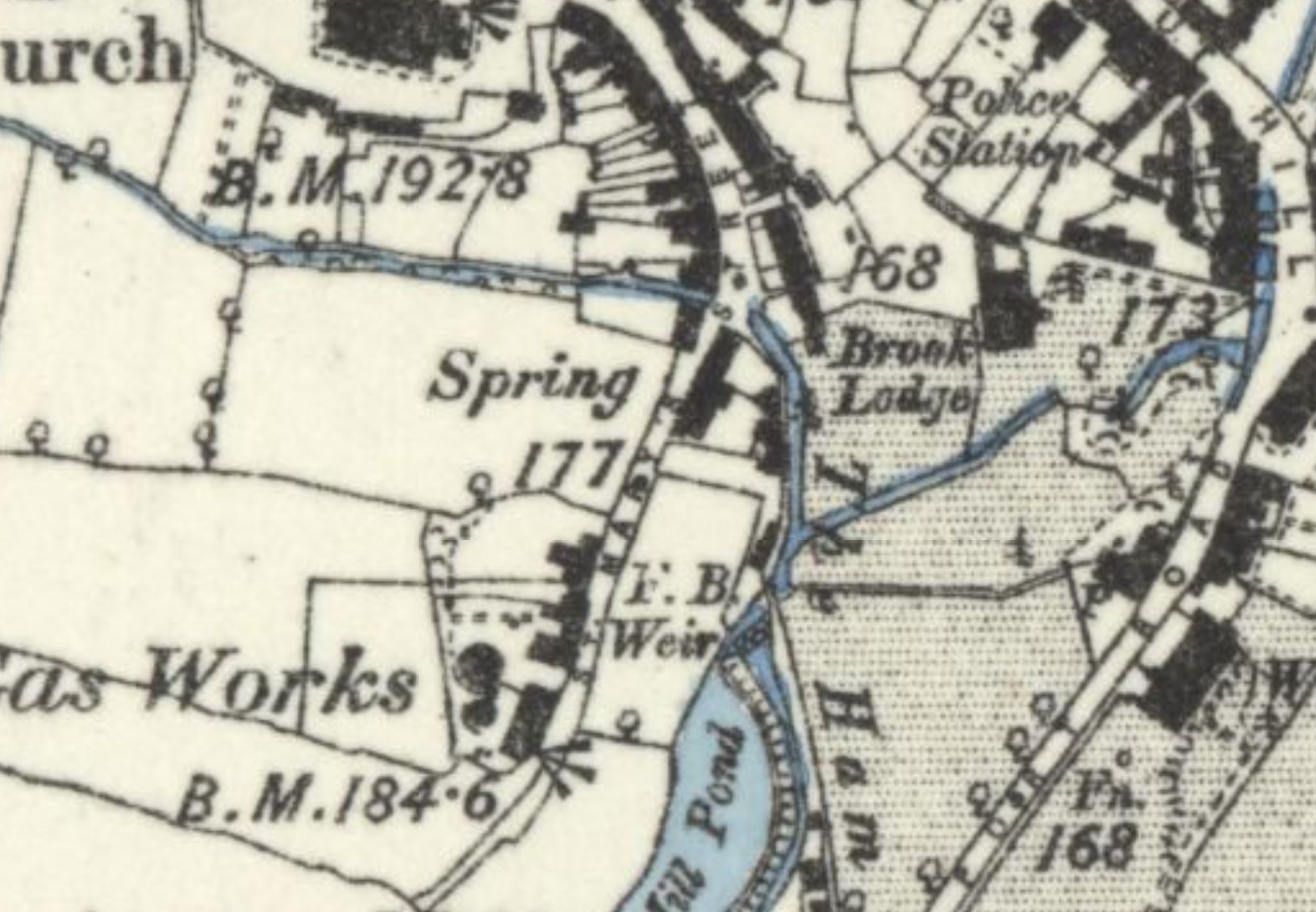
Unfortunately, no historic Ordnance Survey maps explicitly mark the location of St Mary's Well, and even the road on which the spring is (or, perhaps, was) located was called "St. Mary's Street" on OS maps until 1964, in spite of the fact that the parish book shows that it had been known as "Mary Well Street" since at least the late 1600s. Only the 1888 6-inch OS map of Beaminster, the earliest one to be issued of the locality, depicts a watersource that may have been St Mary's Well: this map shows an unnamed "Spring" somewhere either along the western edge of the road, or in a field next to it (it is impossible to tell where exactly this "spring" is on the map). As later maps do not show anything at the site, it is not possible to say whether or not this "Spring" was actually located on Mary Well Street or not.
Intriguingly, however, Hine's description suggests that St Mary's Well was situated along the part of the street that is built over the river, which would potentially rule out this "Spring", depending on where it was actually located. The street has been extended to the south-east over time, and only the northern half is actually constructed over the river, so perhaps St Mary's Well was never actually marked on OS maps at all. Either way, it is also impossible to tell whether the well still exists or not, beneath the roadsurface, as it evidently did in 1914. For this reason, I have been unable to supply exact coordinates for this site.
|
*Location approximate
Images:
Old OS maps are reproduced with the permission of the National Library of Scotland
Copyright 2025 britishholywells.co.uk