 |
Dedication: Saint Tysilio Location: Rhallt, Welshpool Coordinates: 52.679777N, -3.128310W Grid reference: SJ238097 Heritage designation: none |
HOME - WALES - MONTGOMERYSHIRE
|
Dedication: Saint Tysilio Location: Rhallt, Welshpool Coordinates: 52.679777N, -3.128310W Grid reference: SJ238097 Heritage designation: none |
St Tysilio's Spout, located roughly a mile away from Welshpool at the end of a small lane, is one of the oldest known recorded holy wells in Wales, and in fact in the whole of Britain. The first known reference to the well is found in a charter of 1202 in which Gwenwynwyn, the then king of Powys Wenwynwyn (modern day southern Powys), granted land to Strata Marcella, a Cistercian monastery that was founded in 1170. Gwenwynwyn had a direct link to Strata Marcella, as his father not only founded the abbey itself but also spent his last days there and was buried in its grounds; it was possibly for this reason that Gwenwynwyn gifted so much land to the establishment. In this charter, which was originally written in Latin, St Tysilio's Spout is referred to as "Fons Tessilian", which translates to the "fountain", "spring" or "well" of Tysilio. In fact, St Tysilio's Spout is located only a mile away from the site of the monastery, and the well stayed under the ownership of Strata Marcella until the abbey's dissolution in 1536.
It is very likely that the well's dedication to St Tysilio dates back to the time of his life, the 7th century. Tsylio himself had a direct link to Welshpool as it was there that he began his ministry; he later moved to Meifod, only eleven miles away from Welshpool, to study under St Gwyddfarch, and he founded the church there, which is dedicated to him. Over his lifetime, Tysilio travelled across North Wales and founded a hermitage on an island in the Menai Strait, which is now called Ynys Tyslio, which allowed him to spread his ministry to Anglesey. It is in the area around Welshpool, however, that he is properly remembered (or was remembered), as it was back at Meifod that he became an abbot. Wakes were once held on his feast day, the 8th of November, at Guilsfield, which is less than a mile away from the well. In fact, this annual tradition likely involved the holy well in some way.
The well was briefly described in 1925 in the Royal Commission's Inventory of the County of Montgomery:
|
The 'Fons Tessiliau' of Gwenwynwyn, prince of Powys's charter to the abbey of Strata Marcella, A.D. 1202. On the western side of the Rhallt. |
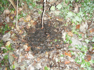
St Tysilio's Well was described in 1981 by Ordnance Survey surveyors as being "Concreted over and grated with an inspection cover, with a few stones scattered about." Although it has always been marked as a "well" on Ordnance Survey maps, it has never been named, and it is only recently that the well has begun to be marked in the Gothic script. The building that has for at least the last century or so been located only metres to the east of the well has seemingly always been known as "Spout House", and still is today. The well is also marked on a tithe map from 1840, and, although the well itself is not named, the adjacent farm house is labelled as "Spout House". In 1840, Spout House, several nearby fields (including one named "Spout House Meadow"), and presumably the well were owned by a Robt Devereux Nicholls, although it was occupied by a Mr John Evans. It seems that the water from the well provided Spout House with a reliable source of water for many years, and likely still does today.
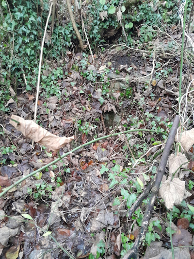
When I visited the well in the November of 2024, it seemed that the condition of the well had not changed at all since 1981: the spring was contained within a square brick tank, maybe half a metre square, with a large manhole cover over the top to provide access to the well. The structure was, in some places, showing its age, and a small trickle of water was leaking out of the tank and issuing into the nearby field in a small stream. It is unclear how old exactly the structure is, but I personally would date it to some point post-1900. It is always possible that some remnant of an original structure from the medieval well still survives beneath the brickwork.
 |
 |
|
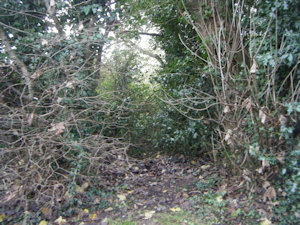
Access: Rhallt Lane, a public road, goes right past the well. A gap in the bushes leads to the well, which is about a metre west of the lane. |
Copyright 2025 britishholywells.co.uk